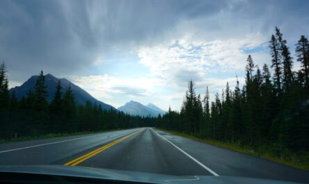

The next two stages took us first to northern Småland (the name is well known to visitors to the famous Swedish furniture store as “children’s drop-off station” 😉 ) and after that to the surroundings of the Vättern, Sweden’s second largest lake.
We stayed 3 nights on the campsite in sight of the lake Mycklaflon that is just under 50 km away from Vimmerby. The town near the birthplace of (next to ABBA probably the world’s most famous Swedish celebrity) Astrid Lindgren. Small story to our domicil. The sanitary facilities were, despite there age, in a good conditon, but we still felt like we were back in our school camp days 🙂

Our first hiking tour led us to the Norra Kvill National Park. In this primeval forrest, which is mostly characterised by pine and spruce trees and moss-covered rocks, no tree has been felled for 150 years. The rounded boulders are the legacy (the so-called moraine) of the last Ice Age, which ended a good 10,000 years ago. We hiked on the 4.5 km long and excellently marked path around the small and large Idgölen and up the hummock Idhöjden (45 m above the lakes and 230 m above sea level). In the direct surroundings of the national park we visited the Kvilleken. The predunculate oak is with a estimated age of over 1000 years largest and oldest tree in Sweden. And another incredeble natural phenomenon was on our day’s route, the Runkesten. It is one of the biggest balanced rocks in the world and can be moved up to 10 cm by human power. A stony balancing act since the Ice Age and source of the following legend at the same time. A giant threw the stone at this spot and threatened to destroy whoever knocked it over.


Day 2 guided us into the Skurugata gorge and up the 337m high Skuruhatt. First we climbed over boulders along the 800 m long gorge, which presumably was formed through the glacial water of the melting ice. At the deepest and narrowest point (only 7m wide and almost 60 m high rock walls on both sides) it does not get warmer than 10°C (and this can be up to 20 degree difference in temperature) in hot summers. On top of Skuruhatt, the third highest mountain of Småland, we stopped for lunch. We had a view over the sea of forrest stretching to the horizon.


For our second stage, we moved with our caravan further towards north. From there we drove (on a puplic holiday) to the Karlsborg fästning, a fortress that became outdated after its finishing (which seems only logical after 90 years of construction). It is still in use as a military school base and it was family visiting day that day. Because of this, the huge complex, which was the size of a small town, appeared very busy. Due to the military use, we were not able to take photos, so we only pictured the small octagonal lighthouse made of wood. Afterwards we drove to Hjo. The village, right on the coast of the Vättern, was the location of a small market that day (there were not any differences to German markets, except the elk kebab, which we intentionally did not try), and unfortunately it was difficult to look at the cosy lanes and houses. At the end of the day, we still visited the klosterkyrka in Varnhem. Most of all, we found the church interesting because of its arcitecture. On a hill directly behind it is Kata Gård, the ruins of a farm church from the Wiking Age. A modern visitor center directly above the remains not only preserves them, but also gives a lot of impressions and information about the history.


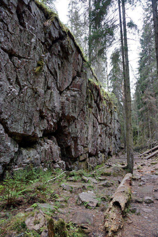
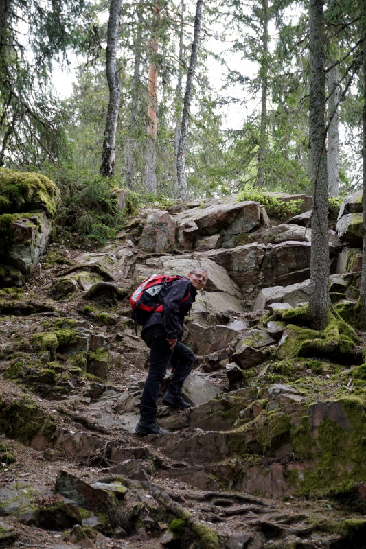
The following two days we tied our hiking boots again, because the Tiveden National Park (even a criterion for the campsite) was right on our door steps. Many marked hiking trails led through the old-groth forrest, which is completely untouched by forrestry. This is characteriesed by centuries-old pines, gently rounded rocks and dark forrest lakes (so-called Tärner). We completed various suggested routes and even combined some. The ways led us both along the banks of the Storra Trehörnigen (you can even find a sand beach here) and over easily walkable forrest floor, we climed over boulders and through some rift valleys. And everywhere among the smoothly polished rocks, edged boulders lay in the middle of the landscape. As if they has been diced there by giants. 🙂 The most impressive examples are the Vitsandsgrottorna and the Junker Jägares sten. The last mentioned, by the way, is about 15 m high. All this natural phenomena (including the beach) are evidence of the last Ice Age and were formed or left behind by it.


Well, that’s all of Sweden’s geological history this time. We hope you haven’t fallen asleep 😉 and look forward to our next reports.
P.S.: By the way, if you’re ever here, you should beware of the trolls! 😉