
…should now await us.
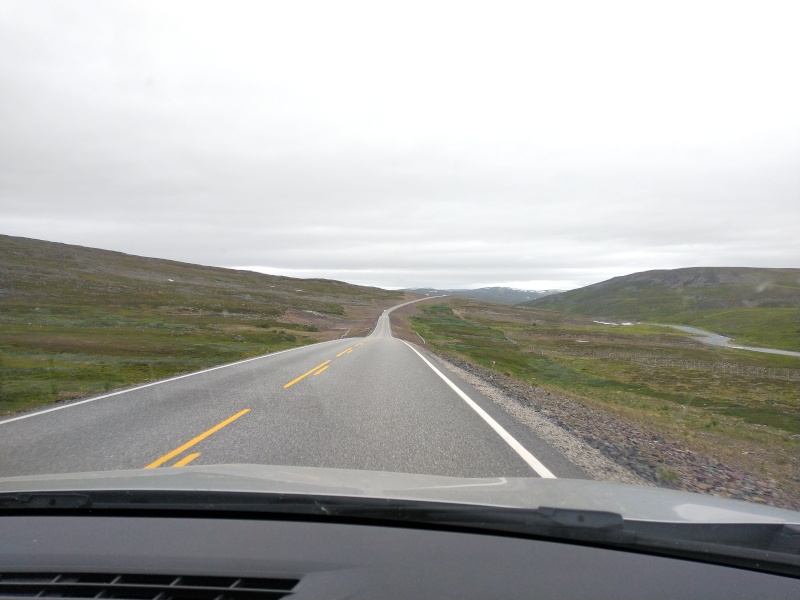
The drive through the Ifjordfjell formed the start of our multi-day excursion into the wideness of the tundra plateaus of northern Norway. Almost endless and incomprehensible open spaces everywhere you looked.
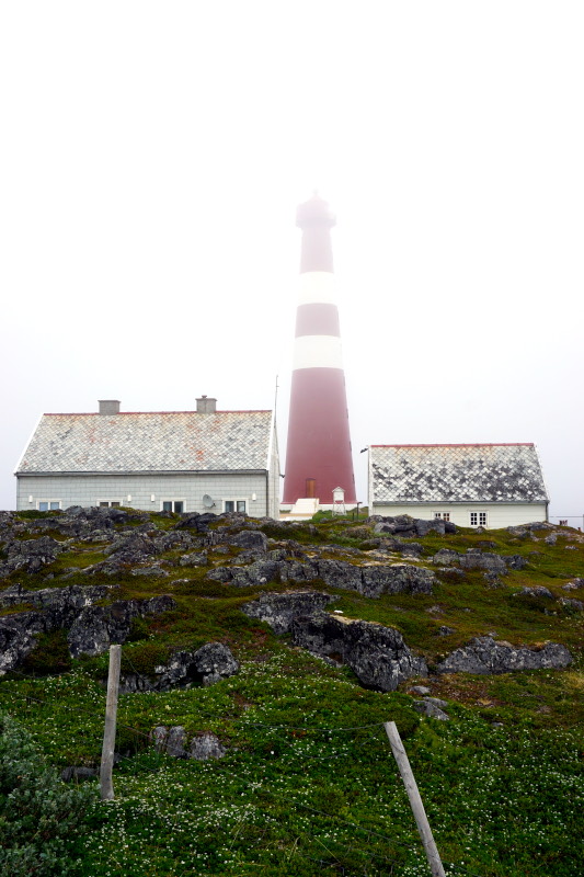
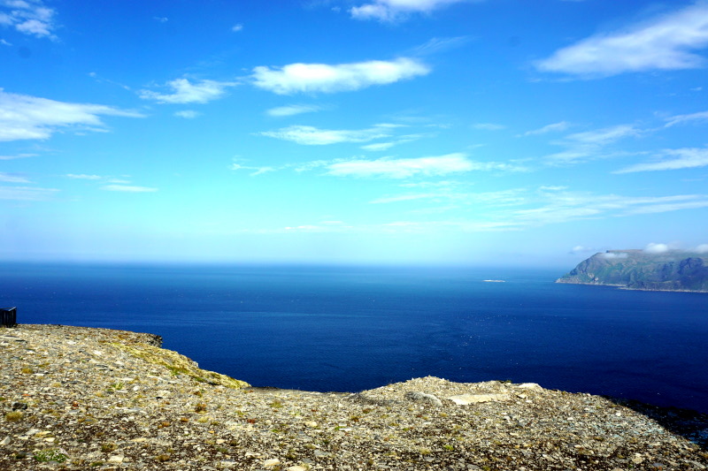
The next day we started collecting northern trophies. On Nordkinnhalvøya, we visited Slettnes fyr, the northernmost mainland lighthouse (and with it, of course, mainland point) in the world, which is accessible by road. The high plateau of this peninsula has an equally indescribable expanse. The eye can hardly find a foothold here, and it is even more impossible to capture it in a photo. Even if we tried. 🙂 Nevertheless, our clear travel recommendation is: Check out Northern Norway if you want to experience the feeling of ultimate solitude and boundlessness!


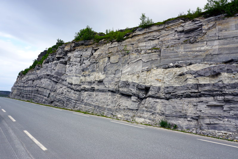
The bare and flat highlands of Børselvjfell were then on our way. A contrast to this was the Silfar canyon at the end of this plain.

Arriving at the western shore of the 123km long Porsangerfjord (the 4th largest in Norway), we unhitched our little home, recharged our batteries and drove a little further up the coast. Here, according to Sami legend, are the fossilised trolls of Trollholmsund. The profane description, pillars of weathered dolomite rock that, with a little imagination, look like trolls.


The next day we followed the Havøysund tourist road to Arctic View. Unfortunately, the weather didn’t play along up here and so we couldn’t see all the way to Spitsbergen.
But as the day was still quite “young”, we drove to Hammerfest, the northernmost town in Norway. On the way there, we finally saw a moose again. Compared to its Swedish counterpart, however, it was very camera shy 🙁
The meridian station in Hammerfest, the destination par excellence for Britt, is fortunately “carved in stone” at its location. It is the northernmost fixed point (of a total of 34 still existing measuring points) of the Struve meridian arc. This survey was used to determine the flattening of the earth and is on the UNESCO World Heritage List (as the first technical-scientific object). Britt can give you more detailed explanations at her leisure 😉


But before we headed back to the campsite, we took a look over to the island of Melkøya. Here is Europe’s largest natural gas liquefaction plant, which was completed in only 4! years.

Next we hiked a leisurely loop in Stabbursdalen nasjonalpark. The first 2 km were through a part of the northernmost pine forest in the world, where we felt “eaten up” by mosquitoes. Even though we had been annoyed by quite a few of these beasts every now and then, the amount here was unbelievable. Fortunately, we walked the last 3 km through open tundra landscape (and thus without mosquitoes) to Stabbursfossen waterfall.


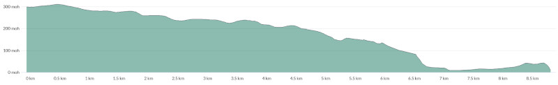
This was followed by a “one-day trip” to the island of Magerøya. This is connected to the mainland via a 6870-metre tunnel (you travel 212 m below the surface of the sea!) and “houses” the world-famous North Cape. For us, however, it was too crowded with tourists (and also too expensive). We also wanted to go to the really northernmost point of the continent, Knivskjellodden. It is located at 71° 11′ 08” (degrees, minutes, seconds) north latitude and thus 47” or 1540m closer to the North Pole than the slate cliff of the North Cape. Immediately after arriving at the next sleeping place, after a snack, we made our way to the car park and tackled the 18km hike (see below for altitude profile). The way to the trailhead was very pleasant, as it was almost all downhill ;-). But the way back was correspondingly exhausting. It took us about 4.5 hours to cover the distance, including a coffee break “at the very top in the north” and many drinking breaks (especially on the way back).


The following morning, before setting off for the next campsite, we “walked” just under 20 minutes to Kirkeporten.


So, that’s it from us for now…more to come soon…stay tuned!
Northern greetings to the people back home! 🙂