


02/02 – 21/02/2023
The next destination was the inactive volcanic cone of Mount Taranaki (the second highest peak on the North Island). It has already been allowed to “double” Mount Fuji (Japan) in films, but on this day it was unfortunately completely hidden in the clouds. During a hike in the surrounding Egmont National Park, we met a staff member who was setting bait traps. In order to protect the native wildlife, introduced species such as stoats and weasels are hunted in New Zealand.


The following day we undertook another hike at the foot of the mountain, this time from another visitor centre. Fortunately, on the way there, at least the summit appeared in the morning sun. The forest we walked through is called “Goblin forest” because most of the trees are covered with mosses and lichens and you really feel like you are in another world.


From Whanganui we headed for the Tongariro National Park. Mount Ruapehu, the highest mountain on the North Island, is located here. Before we started, however, we helped our “campsite neighbour” out of a jam. Luckily it was nothing complicated, because with the help of jumper cables the problem was solved.


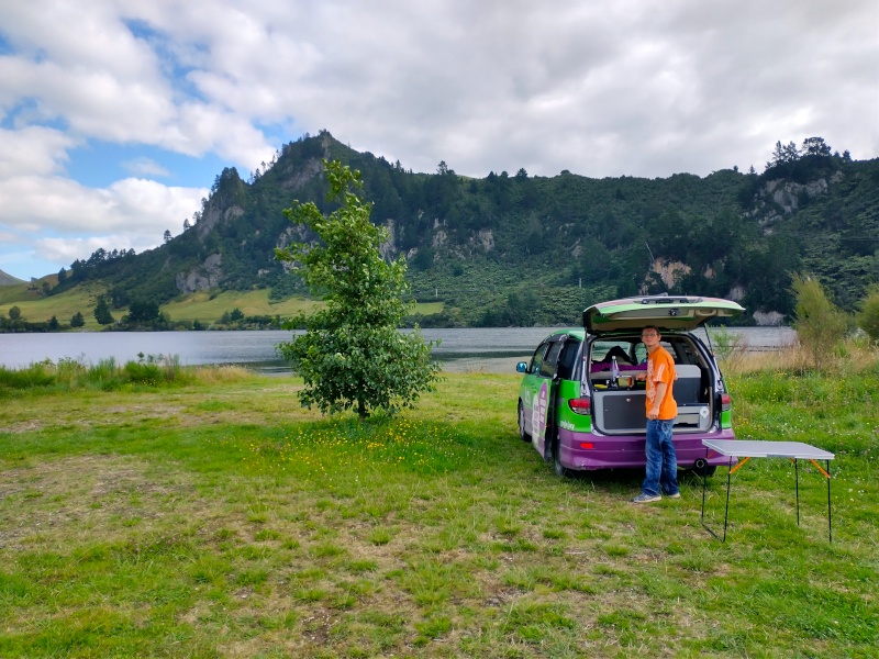
After two more hikes in Tongariro National Park, we stopped at Lake Taupō. This crater lake formed in the caldera of the Taupō Volcano supervolcano (which is still considered active). Its last eruption was over 25,000 years ago, but hot gases still rise from the earth’s interior and bubbling water & mud holes appear in many places. We had a look at some of them in Tokaanu before we drove on to the picturesquely situated (and free 🙂 ) place to spend the night.


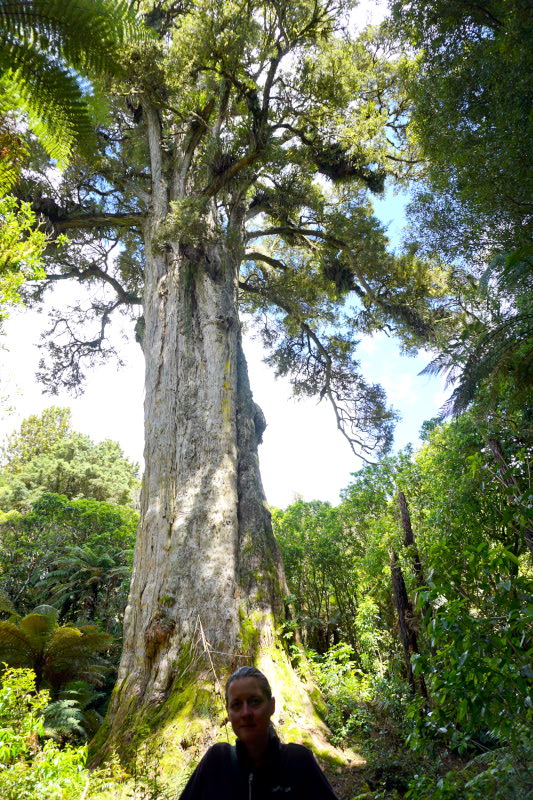
Next we climbed the 1165 m high Mt. Pureora. The starting point for this mountain tour is conveniently not at sea level, so we “only” had to climb about 350 metres to reach the summit cross. Unfortunately, the weather didn’t quite cooperate that day, so we were standing in a cloud at the top. 🙁 Well, at least we did some sport 😉 Afterwards we visited the geographical centre of the North Island. It is especially interesting how the point was determined. They took an approx. 1m map of the North Island, bent it according to the curvature of the earth and then determined the centre of gravity. The day ends with a visit to the Pouakani Tōtara, the largest known Tōtara tree in the world (because it is endemic to New Zealand).


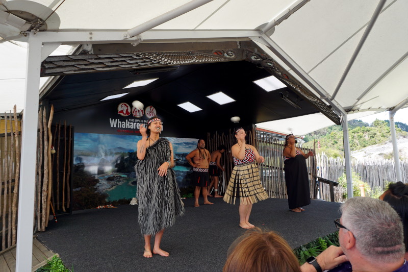
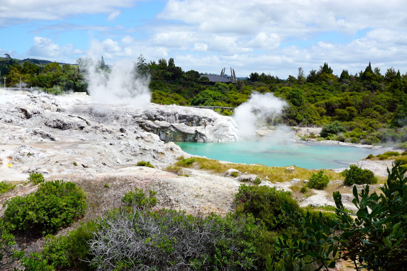
In Rotorua we visited Whakarewarewa. A still inhabited Māori village in the middle of a geothermal field. Everywhere next to the houses, clouds of mist rise from steaming and bubbling water holes. Here & there bubble mud puddles and even several geysers spray water fountains metres high into the air. Some of the 60 inhabitants of the village still cook their food over the rising steam, cook directly in the up to 100°C hot water and have a bath in the village’s own thermal water pools. First we experienced a cultural show with traditional singing and dancing. Afterwards, an inhabitant showed us around “her home” and informed us about the history, way of life and traditions of the local Māori tribe. We learned that the village was rebuilt by survivors of the last big volcanic eruption in 1886. The original settlement was 7 km away and was destroyed or buried at that time.


In Tolaga Bay we hiked to Cook’s Cove. In October 1769, James Cook anchored in this bay to replenish his supplies. This time successfully, because in Poverty Bay, where he had been shortly before, this venture failed due to misunderstandings with the Māori tribe living there.


From here we headed south again and on the following day’s tour to the overnight campsite in Hastings we stopped in Gisborne, Wairoa and Napier.


The following night, Cyclone Gabrielle devastated much of the North Island. The campsite also suffered considerable damage. Several large trees had fallen and damaged holiday cabins and caravans, as well as a sanitary block with an adjacent lounge. In addition, the power was out in the whole town and the mobile phone network was disrupted. So we decided to drive on instead of spending another day here as planned. When we arrived at a pretty little site in the afternoon, we learned that all main roads leading to Hastings were now closed. In addition, a national state of emergency had been declared. Our planned excursions for the next few days unfortunately ended up being cancelled. Many smaller roads were also closed or hiking trails were simply impassable.


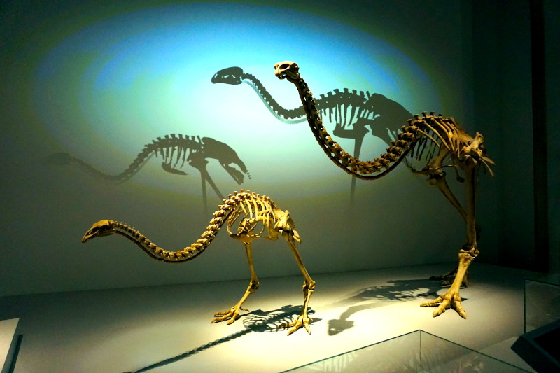
Near New Zealand’s capital Wellington we set up our last base camp before the ferry crossing to the South Island. We spent a whole day in the city, but mainly in the (free!) National Museum. Most interesting for us were the fossils & models of the different species of Moa. These flightless ratites were endemic to New Zealand, but were wiped out by the Māori in less than 100 years. Afterwards we walked through the city centre and looked at the old and new government buildings.


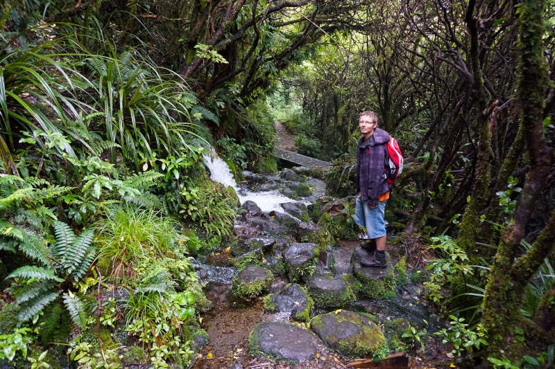
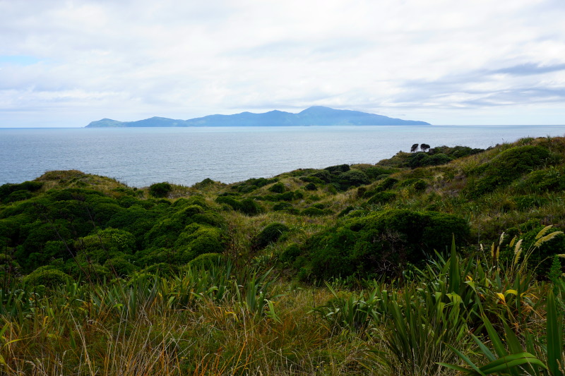
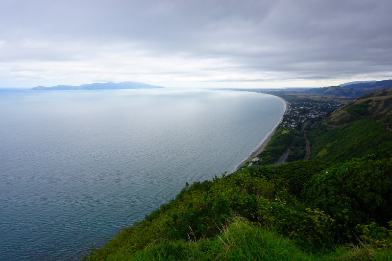
A short walk over sand dunes in Queen Elizabeth Park near Paekākāriki was followed the next day by an adventurous hike in Belmont Regional Park to Dry Creek Waterfall. The trail starts right at the campsite and leads through pristine forest. We followed the marked path along the creek, crossing it several times and climbing over rocks and trees.


With that, we saw everything on the North Island, given the circumstances. The ferry then took us to the South Island. We are already excited about what awaits us here. Talking to some “Kiwis” (no, not the birds and not the fruits :-)), that’s what the inhabitants call themselves, we learned that this part of the country is supposed to be very different. So see you soon. We’ll be in touch again, we promise 😉


