… and tunnels & ferries become a daily companion.
But first we spent 3 days in a row almost exclusively behind the wheel. The “wasp waist” of Norway hardly offered anything interesting for us and the persistent rainy weather also prevented one or two hikes in this area.


On the second day, the time had come. We crossed below the Arctic Circle again! Shortly afterwards we passed our first Norwegian toll station. The toll station works by camera and after registering the vehicle and its user and depositing the bank details (with the Norwegian Road Administration), you receive the toll chip. You stick it in the windscreen and everything else works automatically. No waiting for the invoice (which can take up to three months), no hassle regarding bank transfers and best of all, you get a 10-20% discount on toll passes. 🙂


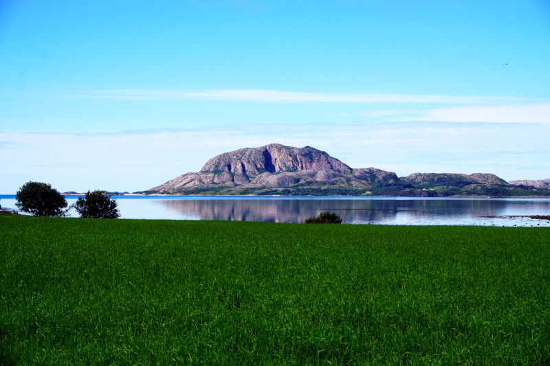
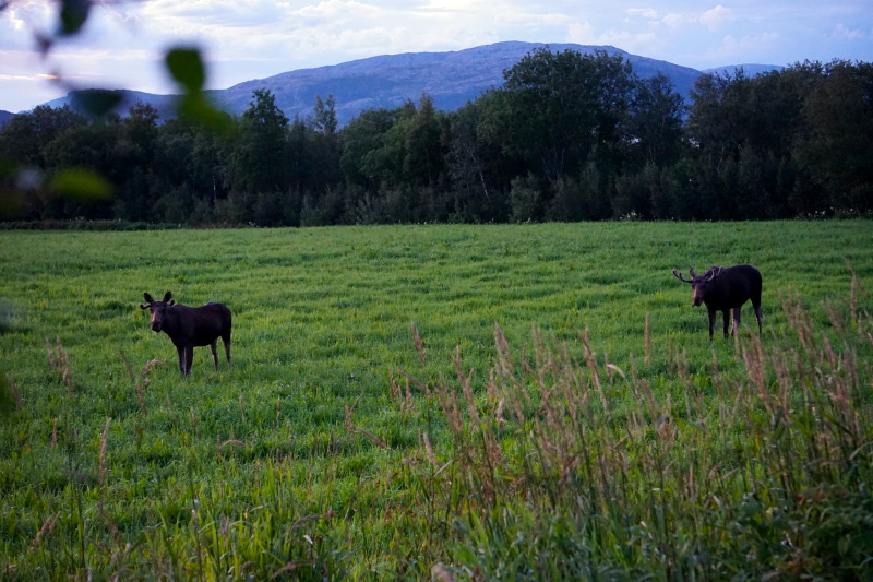
Our destination on the third day was the campsite in Holm, where we stayed again longer than just one night 🙂 Immediately after arrival, we drove over to the island of Leka. It is considered a national geological monument, as rock from the inner mantle can be seen here. The different colours are caused by the oxidation of the rock, depending on the dominant mineral components. On the way back, we were surprised to see another reindeer. But shortly before the campsite it got even better. We could admire 3 moose grazing on the right and left of the road.


The next morning we took the first ferry (it was Saturday, 8:45 am) and went to Torget Island. On the way we also encountered moose, the first two of which were probably the ones from the night before. A short hike, in bright sunshine at last, on and through Mount Torghatten was a relief after the previous days in the car. The hole is 160m long, 35m high and 20m wide and, according to scientific explanations, was probably created by the waves during land uplift. According to legend, however, it is a hat that was pierced by an arrow and petrified at the moment of sunrise. The chain of peaks of the “7 sisters” (daughters of a king who were lying on the beach at that moment), the island of Leka and prominent mountain peaks in the surrounding area also have their origins in this. However, the complete legend is too detailed to be told in this context.


In the evening of this day, things turned out even better than we had ever dared to dream with regard to the largest species of deer found today. No less than 5! Moose were grazing on the adjacent meadow, an estimated 100 metres away from the caravan. Elks in the front garden, so to speak 😀


By the way, it is very interesting to drive along the fjords by car after & on rainy days. Then small and large waterfalls rush down the mountains all along the partly rugged rock faces, giving the landscape another look.


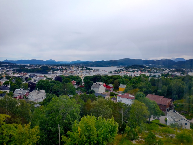
After an overnight stop, we continued on to the vicinity of Kristiansund. On the way, we stopped here briefly and looked out over the tranquil little town from the former watchtower. It has only been connected to the mainland since 1994 thanks to an underwater tunnel. But we still had to go to the neighbouring island to camp. So off we went through the second underwater tunnel. 🙂

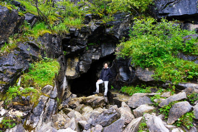
After a “forced rest day” due to continuous rain :-(, we hiked to a marble and limestone cave called Trollkirka. The entrance to the main cave is at an altitude of 484 metres and we reached the second cave about 15 metres above it. But first we climbed another 30 metres up to the mountain plateau. While everything was still covered in fog when we started at the car park, we were fortunately able to look down into the valley after the 1 ½ hour ascent. Back at the entrance to the upper cave, we descended into it via a ladder. Thanks to the rainfall of the last few days, a lot of water was rushing out of the small crevice with a lot of noise. Arriving at the entrance to the lower cave, we set about “lighting up” the 70 m to the waterfall with the help of torches. Normally you could also enter the main chamber of the cave. But unfortunately it was a good half metre under water, thank rain. 🙁


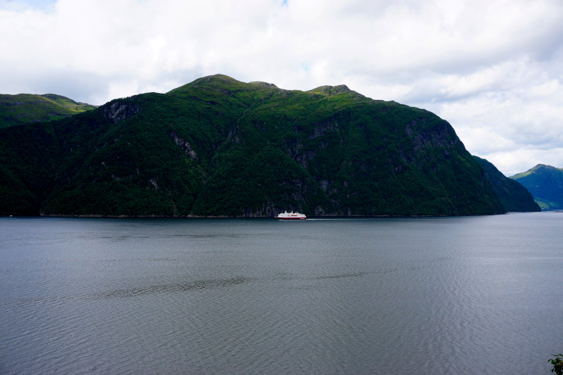
Thanks to two ferry passages, countless tunnels and a view of the Hurtigruten ship Nordlys in the Storfjord, there was no chance of boredom on the drive to the next campsite. This was directly on Europe’s deepest inland lake (514 metres), the Hornindalsvatnet.

Another example of the power of erosion could be seen on the excursion to Kannesteinen. Afterwards we had fun driving thanks to the many serpentines and hardly any traffic on the way to the northern tip of the island of Vågsøy.


The following day was my darling Britt’s birthday. So that means a day of pampering and rest was in order. For breakfast we had pancakes with chocolate spread & banana and for lunch eggs in mustard sauce. 😛

On the stage to the next overnight stop, we crossed the 6.39 km long Fjaerdalstunnelen, among many other more or less long tunnels. It “undercuts” the Jostedalsbreen, the largest glacier on the European mainland. And shortly after the tunnel exit, you could easily see one of its foothills up close, the Bøyabreen. It was really impressive to see this blue wall lying on the mountain. Shocking, though, that just over a hundred years ago the glacier tongue still reached down into the valley.


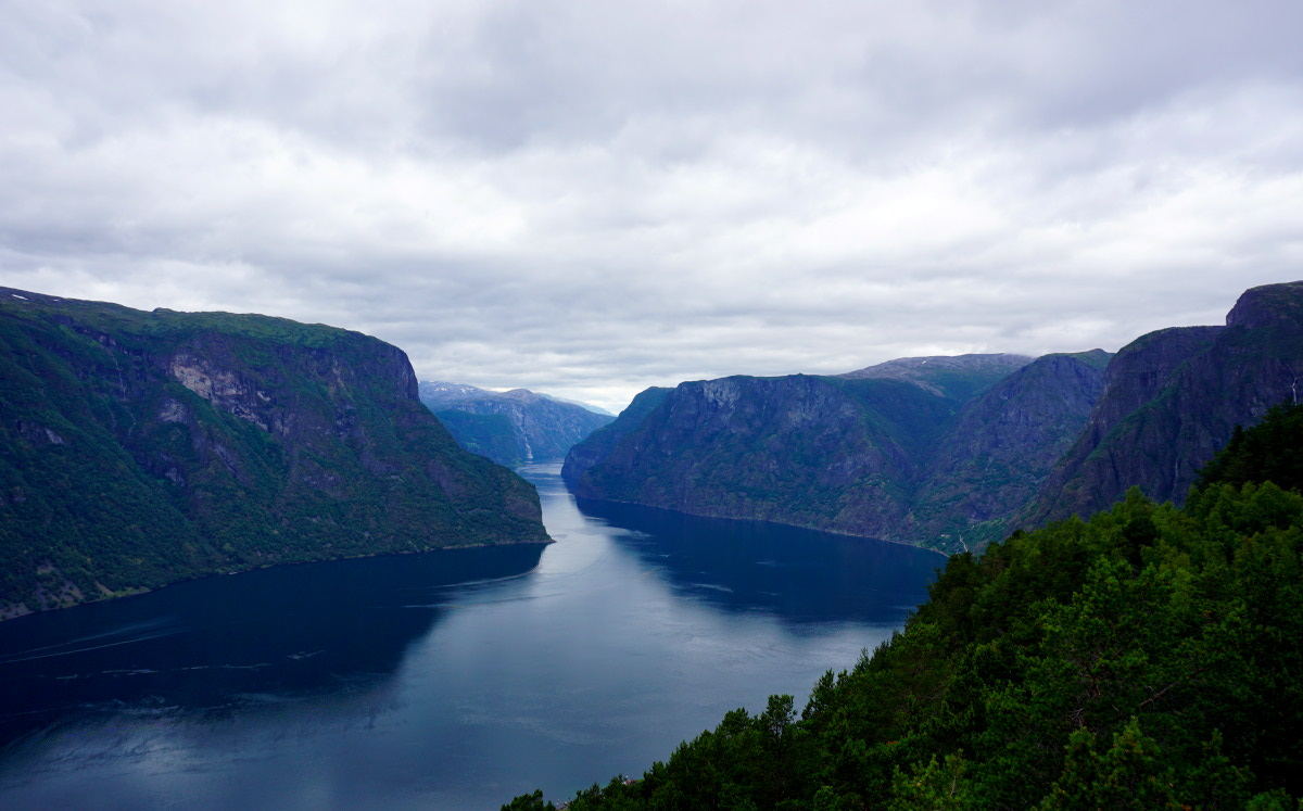
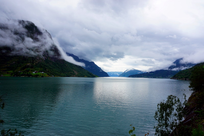
A few kilometres north of the Sognefjord, with 204 km the longest in the world, we “stayed” for a few days. First we took the ferry to the south side of the fjord and directly to the stave church of Borgund. Due to its excellent state of preservation, despite being more than 900 years old, it serves as a model of craftsmanship for the restoration of other stave churches. Afterwards, another architectural highlight awaited us. We drove through the Lærdalstunnelen, which was opened in 2000. At 24.5 km, it is the longest road tunnel in the world and after just 18 ½ minutes of tunnel driving, the fun is already over. 🙂 In order to prevent fatigue on this long stretch, the roadway always runs in slight, large curves and three stop/turning places, which are laid out like halls, are illuminated in blue & yellow. We definitely enjoyed the drive through and it was more entertaining than expected. After stopping at the view into Nærøydalen, we drove back along the national tourist road Aurlandsfjellet. Here, a specially built lookout point offered a fantastic view from above into the Aurlandsfjord.


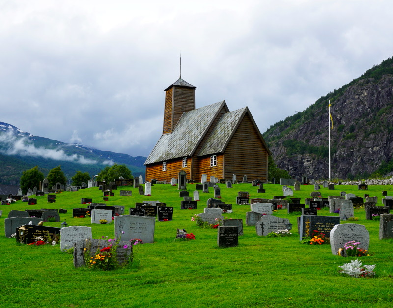
Along the Lustrafjord, a branch of the Sognefjord, we visited more interesting places the next day. First we made a detour to Bergsetbreen, the steepest branch of the Jostedal glacier. This was followed by a view of the 250 m free-falling Feigefossen, the second highest unregulated waterfall in Norway. In Luster we looked at the small gothic church Dale kyrkje, before we left for Ornes. This is the oldest stave church in Norway, built between 1130 and 1150, while Gaupne gamle kyrkje, built in the 17th century, is much younger.


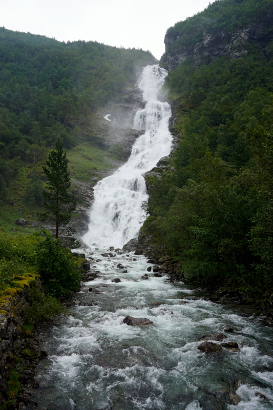
On our to-do list for this region was a hike in Utladalen, on the edge of the range of Jotunheimen, the realm of the giants. The destination was Vettisfossen, Norway’s and Northern Europe’s highest unregulated waterfall, with 275 metres of free fall. On the way there, we not only passed three other falls, but were able to observe other waterfalls on the surrounding mountain slopes.


That’s all for now from the impressive nature and architecture of Norway. See you soon. 🙂